The Netherlands has long been known for its impressive water management systems, and one of its most extraordinary feats is the Afsluitdijk. This 20-mile-long (32-kilometer) dike separates the North Sea from the IJsselmeer, a vast artificial lake that was once a part of the Zuiderzee. Constructed in the early 20th century, this remarkable structure has played a crucial role in protecting the low-lying Dutch landscape from flooding while simultaneously transforming the region’s geography and economy.
The Need for a Great Barrier
For centuries, the Netherlands battled relentless North Sea storms, which often led to catastrophic flooding. One of the worst disasters occurred in 1916, prompting Dutch engineers and policymakers to find a permanent solution. The idea of closing off the Zuiderzee, an inlet of the North Sea, was proposed by engineer Cornelis Lely. His ambitious plan aimed to prevent future floods, reclaim land for agriculture, and create a freshwater reservoir for drinking water and irrigation.
Engineering Marvel of the 20th Century
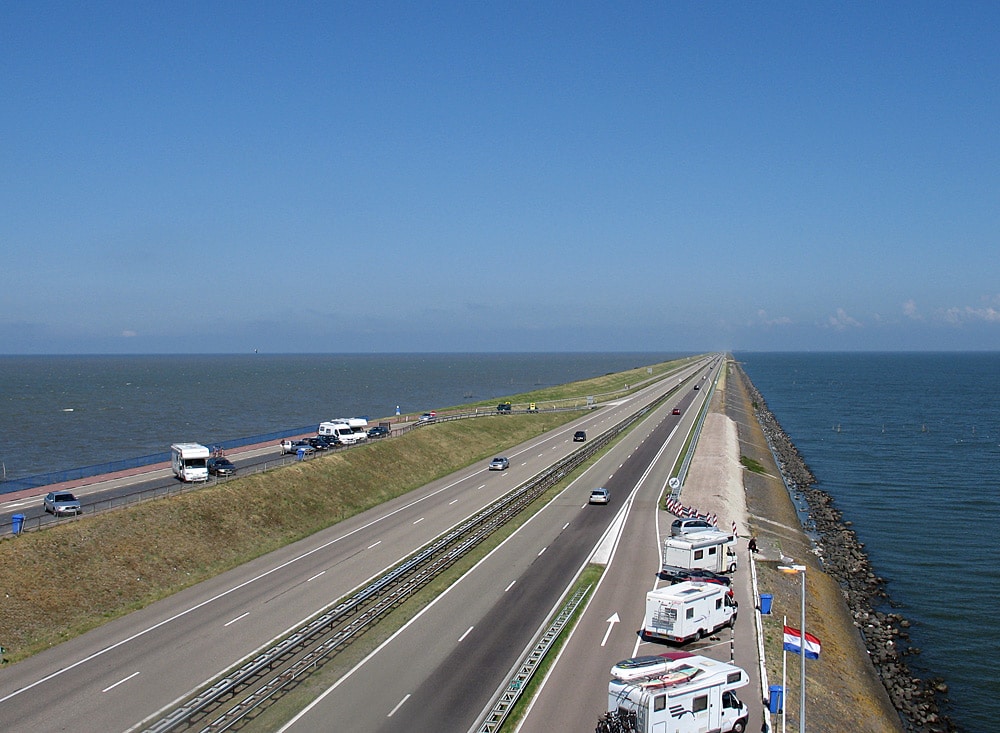
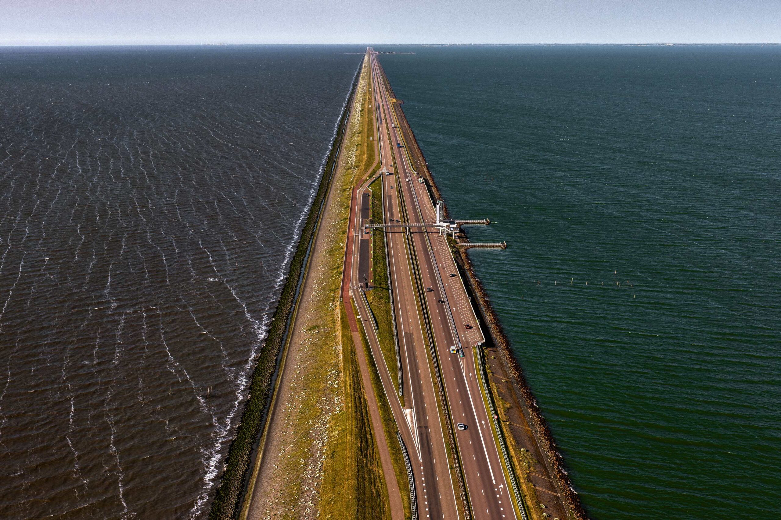
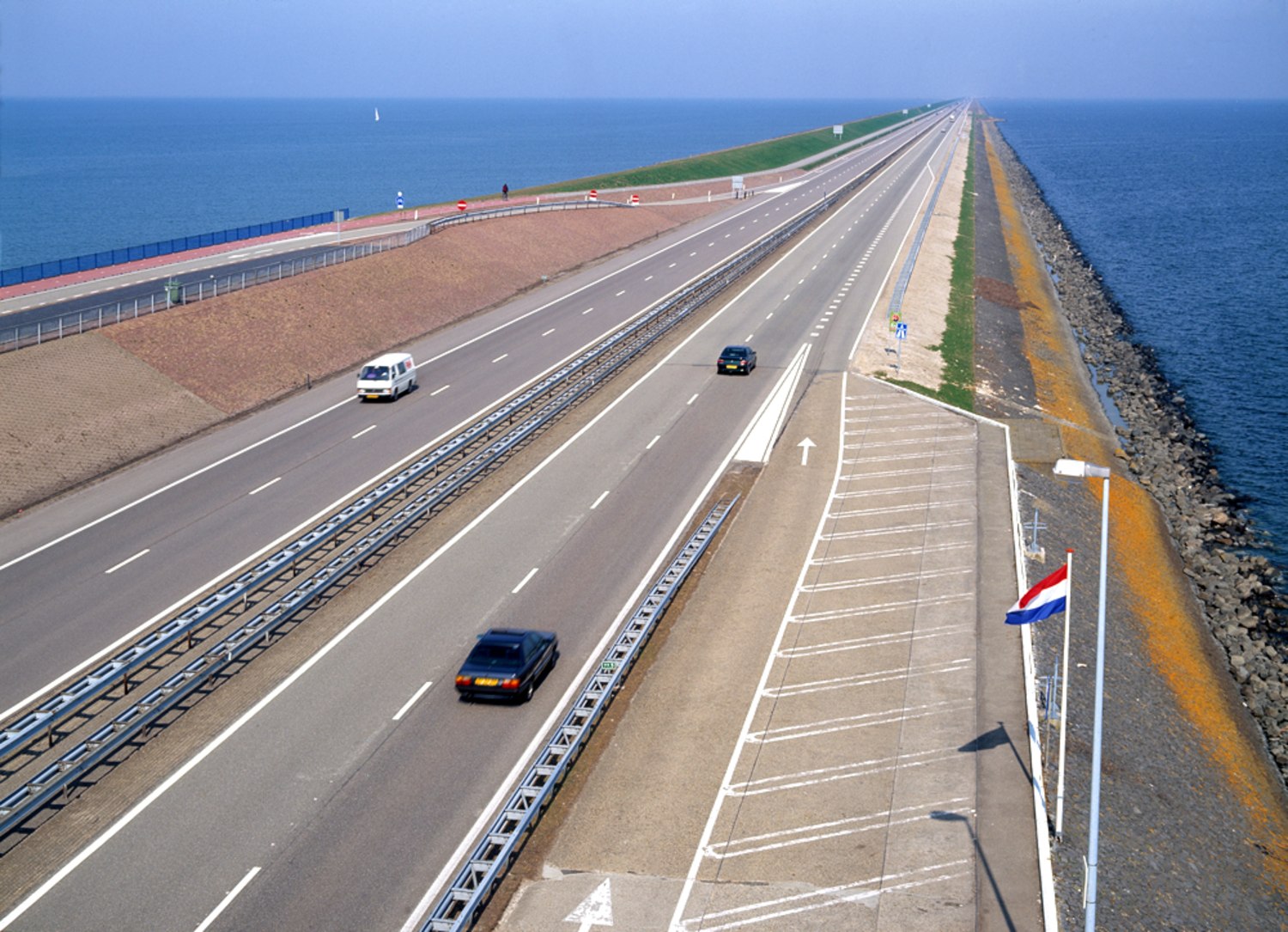
Construction of the Afsluitdijk began in 1927 and was completed in 1932. The project required immense labor and ingenuity, as workers had to transport and place millions of cubic meters of sand, clay, and boulders to form a solid barrier. The dike, stretching from Den Oever in North Holland to Zurich in Friesland, stands about 25 feet (7.25 meters) above sea level and is around 300 feet (90 meters) wide.

To ensure the continued flow of water and prevent stagnation, large sluice gates were integrated into the structure. These allow excess water from the IJsselmeer to be released into the Wadden Sea during low tide, maintaining the balance of water levels and preventing inland flooding.
Transforming the Dutch Landscape
The completion of the Afsluitdijk dramatically altered the Netherlands’ geography. The former saltwater Zuiderzee gradually transformed into the freshwater IJsselmeer, which enabled the creation of new polders—reclaimed land used for farming and settlements. This increased agricultural productivity and provided new opportunities for urban development.
Additionally, the Afsluitdijk improved transportation and connectivity between North Holland and Friesland, serving as an essential roadway for vehicles and cyclists.
Modern Upgrades and Climate Adaptation
As climate change increases the risks of rising sea levels and extreme weather events, the Dutch government has undertaken major upgrades to the Afsluitdijk. The latest enhancements include reinforcing the dike with stronger materials, improving drainage systems, and installing new pumping stations to efficiently manage water levels. These improvements ensure that the Afsluitdijk remains a robust defense against the sea for generations to come.
A Symbol of Dutch Innovation
The Afsluitdijk is more than just a flood barrier; it represents the Netherlands’ mastery of water management and determination to coexist with nature. It stands as a global example of engineering brilliance, demonstrating how human ingenuity can turn environmental challenges into opportunities. As the world faces increasing climate threats, the lessons learned from the Afsluitdijk continue to inspire innovative solutions for coastal protection worldwide.